How Britain Became The Center Of The World
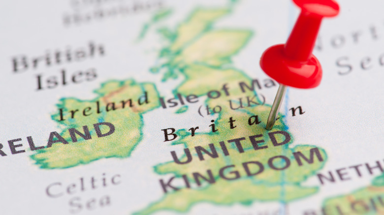
Many of us learned about the different map projections in school, their uses, and the various ways our round Earth is distorted on these flat surfaces. Covered in those lessons as well is the fact that the center of most world maps we use corresponds to the line of longitude known as the Prime Meridian, the center point of navigation and standard time the world over. That line happens to pass directly through Great Britain and the royal observatory at Greenwich, a borough of London (per Royal Museums Greenwich).
Greenwich and Britain have marked the world map's center point since the International Meridian Conference of 1884, a 25-nation conference held in Washington D.C. (per Greenwich Mean Time). Prior to the conference, there was no set reference point for measuring navigation or time. Many maps measured from the home country of the cartographer or commissioner; a French map would use Paris for its prime meridian, for instance, unless it was made in another part of the country that used a local landmark, while both conflicted with a German map that measured from Berlin and so on (per National Geographic). And time zones numbered 144 in the United States alone according to the Bureau of Transportation Statistics. The conference moved to set a single meridian and a standardized day. Because Greenwich was the prime meridian relied on by charts used in the majority of world trade at the time, it was put forward.
Britain's empire influenced the Prime Meridian
The reason why Greenwich was the favored meridian of maps and charts of the late 19th century would be self-evident at the time: it was the heyday of the imperial project, and the British Empire loomed larger than all the rest. Per Britannica's timeline, the empire had already established its control over India, New Zealand, Australia, Canada, and other territories by the time of the International Meridian Conference, and the following year, it would take the lion's share of territory in the Berlin West Africa Conference. Given its expanding global reach and economic power, Britain was well-positioned in putting Greenwich forward as the prime meridian; after all, they had been using it (with adjustments) since 1721 according to IFL Science, due to the improved measurements done from its observatory.
That didn't mean Greenwich's claim was uncontested. The United States had accepted Greenwich time as the standard for its reformed time zone system, but according to ThoughtCo, some of its delegation to the conference looked down on Greenwich as an unworthy location for the center of the world. Washington D.C. was proposed as a candidate, as were Kyoto, Rome, Jerusalem, Mecca, and the Pyramid of Giza. Even another part of London, St. Paul's Cathedral, was nominated. But when the votes were cast, 22 out of 25 countries approved Greenwich as the Prime Meridian. Among the holdouts was Britain's ancient enemy France, which clung to the Paris meridian until 1911.
Greenwich has practical advantages as the center of the world
It wasn't only the might of the British Empire that influenced the position of the Prime Meridian. Even if it was a knock-on effect of Britain's reach, the fact that 72% of trade (per Royal Museums Greenwich) depended on maps made it a practical choice and practical considerations were an issue leading up to the International Meridian Conference. Before governments took up the job, the emerging communications and rail technologies of the Industrial Revolution necessitated a standard measurement of time.
Britain's empire is gone today, and its reputation as a global power hub and power has become an open question in the wake of Brexit (per National Geographic). What's more, the standardization project that put Greenwich and Britain down as the center of the world came with consequences. Professor Vanessa Ogle told the Boston Globe about the long resistance people had to working from a standardized clock rather than the natural rhythms of the sun and moon, and the feeling of imperial imposition non-Western countries experienced.
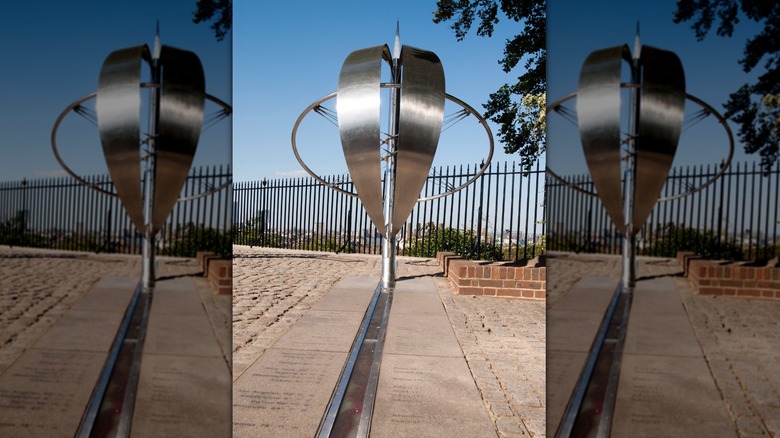
Despite such objections, Greenwich has worked out well as the measuring stick for maps and time. As a lecturer at California State University noted, it simplified the placement of the International Date Line and inconvenienced the least number of people possible. But geographically, the Prime Meridian no longer falls on the marker at the Greenwich observatory; improved measurements via satellite have nudged it slightly outside the observatory's grounds according to IFL Science.