What Is A Derecho And Why Are They So Dangerous?
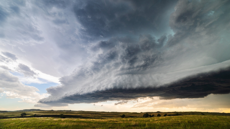
In late June 2023, a circular formation of powerful thunderstorms caused wind gusts of nearly 90 mph and left thousands of businesses and homes without power across several Midwest states, CNN reports. This bow-echo thunderstorm complex met the standard definition of a derecho, a somewhat rare weather occurrence most common in the American Midwest, according to SciJinks from the National Oceanic and Atmospheric Administration (NOAA). Like hurricanes and tornadoes, derechos are characterized by strong and destructive winds with a few crucial differences.
Unlike hurricanes and tornadoes, which spiral, a derecho's strong winds move only in one direction, causing a single path of destruction. A derecho must otherwise be at least 60 miles wide and 400 miles long with wind speeds of at least 58 mph throughout most of its length. In the past, derecho wind speeds have been recorded as high as 130 mph, on par with some major hurricanes. Severe tornado winds, by contrast, must be at least 158 mph, and increase from there. A Spanish adverb, in this context the word derecho means something like "in a straight line" or "straight ahead" (via ThoughtCo.).
Derechos are caused by downbursts
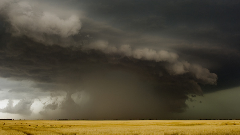
What causes a derecho, according to NOAA, are downbursts. Downbursts happen when wet humid thunderstorms interact with drier air, causing the atmospheric thunderstorm moisture to evaporate. The surrounding air then cools while increasing in density. Because of that density, the air gets pushed down toward the ground and causes strong winds, called downbursts. By doing so, even more dry air gets sucked into the hot and humid thunderstorm system, as the downbursts strengthen and sometimes cluster — stronger downbursts equal stronger winds, and it all travels in one direction in a united front.
Like what happened in the 2023 Midwest derecho, something called a bow echo can form — a gang of powerful thunderstorms that all travel in one single direction in an arced formation. Long-lasting bow echos or a series of bow echos all grouped together become derechos. Satellites help predict the path derechos take, and the earliest derecho known to science is thought to have been observed by University of Iowa physics professor Dr. Gustavus Hinrichs, who coined the term in the 1880s. A Hinrichs paper published in the American Meteorological Journal in 1888 seems to describe a derecho crossing the Iowa plains in 1877. Meanwhile, Derechos also sometimes happen in the American Northeast.
There are different kinds of derechos
With that mixture of wet, thunderstorm air interacting with hot and dry air around it, derechos are often associated with heat waves, according to the NOAA. There are also a few different kinds of derechos, including serial derechos — multiple bow echos clustered together — and progressive derechos, which are smaller and narrower than typical derechos but no less powerful. Just like high winds, when a derecho strikes, those who are outdoors are most at risk, but the danger of falling trees, flying objects, and downed power lines remain even for those indoors.
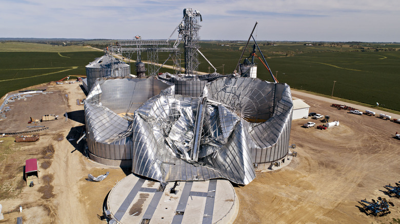
According to The Washington Post, the worst derecho in recent memory hit the Cedar Rapids, Iowa area in 2020. Winds reached up to 140 mph, the thunderstorm complex was a catastrophe for Iowa's corn harvest — causing billions of dollars in damage — and four people were killed. Damaged grain bins from that storm can be seen above. Eight years earlier, a powerful derecho left millions without power in the midst of a record heatwave (via The Weather Channel). That derecho traveled 650 miles with winds exceeding 80 mph, 13 people were killed, and power was lost from Indiana to New Jersey, MSNBC reported,